Resource
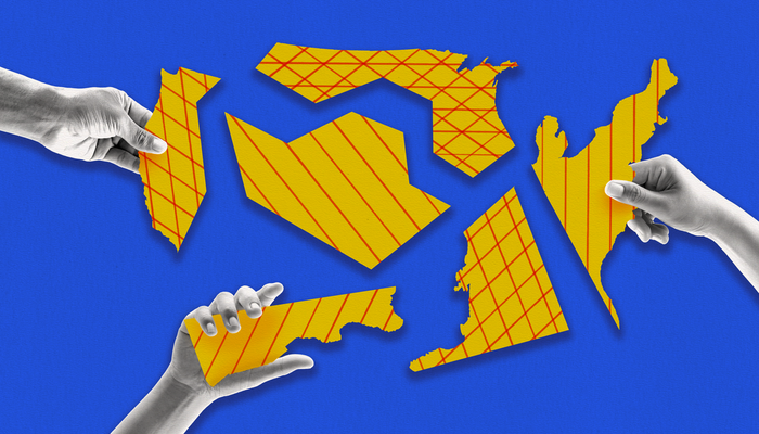
Who Controlled Redistricting in Every State
While most congressional districts were drawn in partisan processes this redistricting cycle, state courts and independent commissions played a bigger role than ever.

Part of

In the latest redistricting cycle, as in previous ones, a majority of congressional districts were drawn through map-drawing processes controlled or dominated by one party, with 26 states passing maps on a wholly or mostly party-line basis.
But the cycle also saw notable changes, with two additional states using independent commissions for the first time and an increased number of maps drawn or modified by state courts. All told, independent commissions and courts each drew around a fifth of congressional districts.
Of the remaining 8 percent of districts, located mostly in the western United States, the majority were drawn by political commissions. Another six states have only a single House seat and did not need to redistrict, while Maine passed its congressional map under a bipartisan compromise.
The maps differ significantly in their political effects. Overall, redistricting bodies that were insulated from partisan interests had relatively more competitive seats, with court-drawn maps having the most by far.
States Where Republicans Drew the Maps
Republican state legislators controlled the drawing of congressional districts in 19 states, whose 177 districts make up 41 percent of seats in the House.
In all but three states, Republicans had control of both the legislature and governorship and were able to pass maps without support from Democrats. The exceptions were Kansas, Kentucky, and Louisiana, where Democratic governors vetoed the legislatures’ maps. Even still, Republicans were able to override the vetoes and put their maps into place.
In most states where Republicans controlled the process, the path maps took to final passage was straightforward, with some notable exceptions.
In Florida, Gov. Ron DeSantis (R) vetoed the proposals drawn by members of his own party, and in an unprecedented move, his office proposed its own map that was even friendlier to Republicans and dismantled a North Florida congressional district that has consistently given Black Floridians the opportunity to elect the candidate of their choice. After the governor successfully strong-armed the legislature to pass his plan, voting rights organizations filed a lawsuit challenging the map. But Florida’s supreme court justices, a majority of whom DeSantis appointed, declined to block the map from going into effect while it continues to be litigated in lower courts.
Meanwhile, the Republican map initially passed by lawmakers in Ohio had to be redrawn after a state court ruled that it violated anti-gerrymandering provisions in the state constitution. However, Ohio’s Republican-controlled redistricting commission simply replaced it with another gerrymandered map that will be used in the 2022 midterms despite subsequently having been deemed unconstitutional by the Ohio Supreme Court.
In Iowa, the nonpartisan staff responsible for drawing maps was required to revise its proposed map, which the legislature subsequently approved. Finally, Utah used an advisory commission for the first time this decade. However, the legislature ignored the commission’s proposals, which could have created a competitive Democratic-leaning district in Salt Lake City, and instead instated a map in which all four of the state’s congressional districts are solidly Republican.
States Where Democrats Drew the Maps
Democratic state legislators controlled the drawing of congressional districts in seven states, whose 49 districts make up 11 percent of seats in the House.
Compared with Republicans, Democrats started the redistricting cycle in a much weaker position, initially holding legislative trifectas in only six states: Illinois, Nevada, New Mexico, New York, Oregon, and Rhode Island. In addition, in Maryland and Massachusetts, Democrats had effective control of the process because of their ability to override vetoes by Republican governors.
Enacting plans also proved rockier for Democrats, with state courts ordering redraws of maps in Maryland and New York. Democrats were able to retain control of the redrawing process in Maryland, replacing a map originally enacted over the veto of Gov. Larry Hogan (R) with a new map that the governor found acceptable and signed into law. By contrast, in New York, the state court that struck down Democrats’ highly aggressive gerrymander appointed a special master to redraw the state’s congressional map.
However, Democrats did have success in drawing maps to their advantage In Illinois, Oregon, and New Mexico.
Most notably, Democrats’ congressional map in Illinois dismantled two Republican-leaning seats, including that of January 6 committee member Rep. Adam Kinzinger (R).
In Oregon, the legislature’s party leaders initially struck a deal that gave Republicans an equal say in determining the congressional map, but the Democratic house speaker withdrew from the deal, allowing Democrats to pass their plan without bipartisan support.
New Mexico’s redistricting process played out similarly to that in neighboring Utah — the Democratic-controlled legislature ignored the advisory commission’s proposal and passed a plan intended to make all three of the state’s congressional districts favorable to the party.
By comparison, maps passed with little controversy in two heavily Democratic states. Though Democratic legislators in Massachusetts had sufficient numbers to override a veto from Gov. Charlie Baker (R), he ended up signing the map into effect without incident. And Rhode Island’s Democratic-controlled legislature opted to pass the status quo plan drawn by advisory commission staff, earning praise for not gerrymandering the map to favor Democrats.
Of the 49 districts drawn by Democrats, there are 39 solid Biden districts, 6 solid Trump districts, 4 competitive Biden districts, and no competitive Trump districts. This compares to 36 solid Biden districts, 8 solid Trump districts, 4 competitive Biden districts, and 3 competitive Trump districts under old congressional maps.
Split Control
Maine was the only state where the legislature was required to pass a map on a bipartisan basis and successfully did so. Because the legislature was required to accept or amend an advisory commission’s map by a two-thirds vote, a bipartisan compromise was necessary because Democrats did not have enough seats to push through a plan that gave their party an advantage. Both districts remained largely the same, with one solid Biden district and one competitive Trump district.
Court-Ordered Maps
State courts drew the maps in eight states, whose 91 districts make up 21 percent of seats in the House.
Courts drew maps because of some impasse in the political process or because a state court rejected a map. In most cases, the courts appointed subject-matter experts known as special masters to draw the maps.
In four states — Minnesota, New Hampshire, Pennsylvania, and Wisconsin — the governor and legislature were unable to agree on a map. In Connecticut, Democrats lacked the two-thirds majority needed to pass a map on their own and could not obtain the required Republican support. And in Virginia, the state’s new advisory commission failed to overcome its partisan divisions and was unable to approve a plan, making the state supreme court the arbiter of the congressional map.
State courts differed in how they adopted new maps. In the key swing states of Wisconsin and Pennsylvania, the state supreme court picked the plan favored by the Democratic governor over the one proposed by the Republican-controlled legislature. These new maps largely resemble the old ones as the special masters chose a “least-change” redrawing approach. Democrats are still at a disadvantage in Wisconsin, however, as the state’s old congressional map had been purposefully drawn to heavily favor Republicans. By contrast, in New York and North Carolina, state courts used special masters to redraw maps passed by legislatures that had been struck down for violating the redistricting requirements defined in state law.
Of the 91 districts drawn under a court’s authority, there are 36 solid Biden districts, 18 solid Trump districts, 21 competitive Biden districts, and 16 competitive Trump districts. This compares to 45 solid Biden districts, 30 solid Trump districts, 9 competitive Biden districts, and 8 competitive Trump districts under old congressional maps.
Maps Drawn by Independent Commissions
Independent commissions drew maps in four states, whose 82 districts make up 19 percent of seats in the House.
Under an independent commission, legislators may have an opportunity to shape the pool of candidates under consideration, but some combination of random draw and selections by nonpartisan staff or judges ensures that everyday citizens decide congressional lines, instead of politicians. The independent commissions and their nonpartisan staff drafted each plan and sought feedback from the public before choosing a final map.
Of the 82 districts drawn by independent commissions, there are 55 solid Biden districts, 16 solid Trump districts, 7 competitive Biden districts, and 4 competitive Trump districts. This compares to 56 solid Biden districts, 14 solid Trump districts, 5 competitive Biden districts, and 8 competitive Trump districts under old congressional maps.
Maps Drawn by Political Commissions
A commission composed of partisan appointees and politicians from both parties drew congressional maps in five states, whose 28 districts make up 6 percent of the House.
While not as removed from the political process as independent commissions, these political commissions were not advisory, and their members had final authority to pass a map. In Hawaii and Idaho, the commissions passed the congressional maps by overwhelming bipartisan margins. In Washington, the commissioners ultimately passed a plan, though the state supreme court did have to rule on it as the commission did not meet its constitutional deadline. In Montana and New Jersey, the nonpartisan chairs had to break ties between partisan members’ proposed plans, choosing the Republican and Democratic plans, respectively.
Of the 28 districts drawn by political commissions, there are 17 solid Biden districts, 6 solid Trump districts, 2 competitive Biden districts, and 3 competitive Trump districts. This compares to 14 solid Biden districts, 6 solid Trump districts, 3 competitive Biden districts, and 3 competitive Trump districts under old congressional maps.
What’s Next for Redistricting
Although district lines are now set for the 2022 midterms, map drawing is not done for the decade.
Under court orders, Ohio and North Carolina’s maps can only be used in the 2022 midterms and will have to be redrawn before the 2024 elections. Alabama, Georgia, and Louisiana may also have to redraw maps to create additional Black opportunity districts depending on how the Supreme Court rules in Merrill v. Milligan this term. Other legal challenges to maps are pending elsewhere that also could result in changes to maps.
Additionally, some states may take the unusual step of redrawing congressional lines mid-decade to shore up partisan advantages or to take advantage of a changing legal landscape. In short, the political and legal fights over congressional maps — and especially who draws them — are far from over.
More from the Assessing the Redistricting Cycle series
-
Anti-Gerrymandering Reforms Had Mixed Results
Redistricting reforms creating independent redistricting commissions resulted in fairer maps, while less robust reforms struggled. -
Gerrymandering Competitive Districts to Near Extinction
The House is still up for grabs, but which party gains control will be determined by races in an increasingly small number of districts. -
After Redistricting, Here’s How Each Party Could Win the House
Partisan gerrymandering has continued to skew maps in favor of Republicans, but both parties still have viable paths to win control of the House in future elections.


Stay up to date